Big Bend, Texas

Mapping the Geology of the North-eastern Rosillos Foothills

Spring, 2018

Introduction

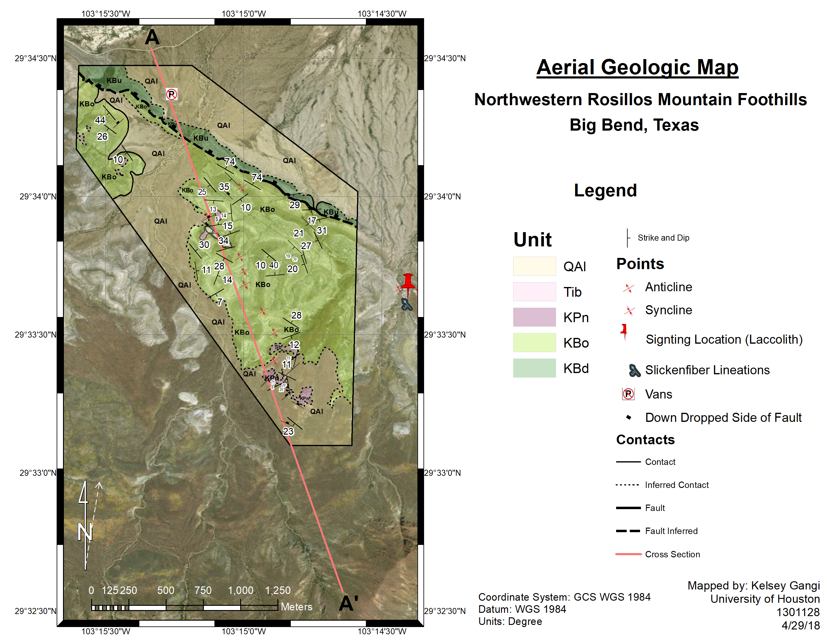
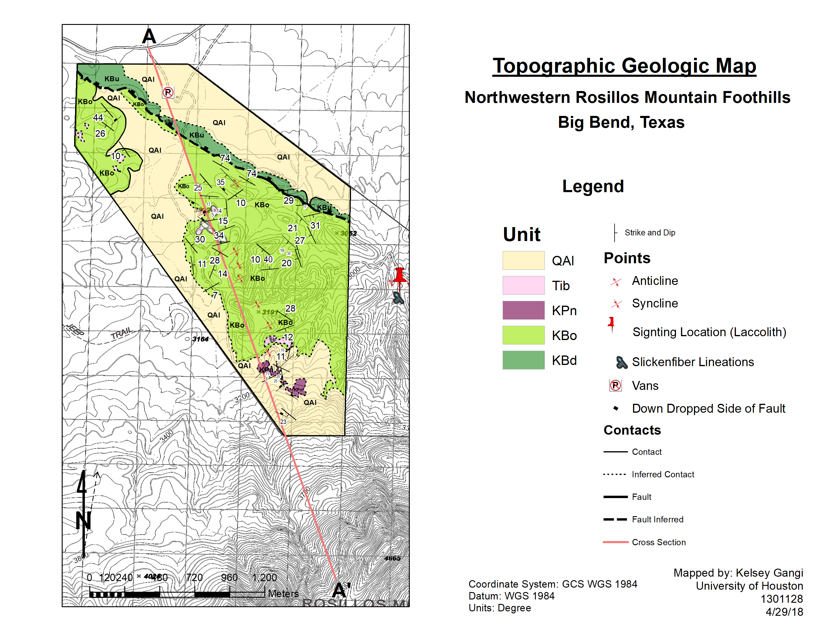
This field mapping project was undertaken as part of a 3-day field trip to Big Bend National Park with my structural geology class, taught by Dr. John Casey at the University of Houston in the Spring of 2018.

An extensive normal fault, the Chalk Draw Fault, also traverses the northeastern portion of the mapping area. The geology of this area is largely the result of deformation associated with the Laramide orogeny.

Additional information regarding the geologic background of Big Bend can be found here.

Mapping

The mapping area was traversed over the course of three days to characterize the locations of different lithologies and structural geology of the region. Several lithologies were mapped in rugged desert terrain, which included quaternary alluvium deposits, tertiary igneous basalt intrusions, and cretaceous limestones the of Boquillas, Buda, and Penn Formations.

Jacob Staffing to create a stratigraphic column with Monica, my good friend!

Results

Typically our professors at UH prefered us to create hand drawn and colored maps for all field mapping projects, and I certainly completed my fair share of them. However, upon leaving the field area, I decided to digitize my paper field map as an experiment this time so I could see the practicality of comparing my field notes (see the image below in the gallery) to satellite photography that was available online.

I found that having the aerial imagery greatly improved the quality of my interpretations because it allowed me to correct for several mistakes I had made in the field, as well as interpolate for any missing geologic data within areas that were unable to be mapped. Having a digitized version also allowed me to digitally render a topographic profile from A to A’ which saved a lot of time because the profile did not need to be drawn out by hand. Ultimately, this project was a great learning opportunity and an amazing experience spent with great friends!

Geologic Map of the Northeastern Rosillos Mountains. Move the slider on the image to view the differences between the aerial and topographic maps.

Trip Photo Gallery